Low-Moderate
Latest from the National Hurricane Center:
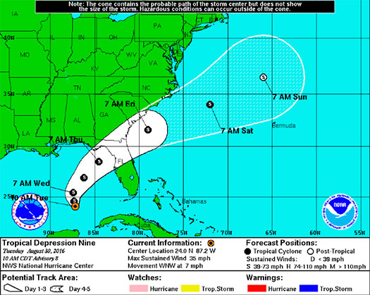
“The depression is moving toward the west-northwest near 7 mph (11 km/h). A turn toward the northwest is expected later today, followed by a turn toward the north-northwest tonight. A turn toward the north-northeast is expected on Wednesday. On the forecast track, the center of the depression will continue to move slowly away from western Cuba, and move over the eastern Gulf of Mexico during the next 48 hours.”


FMIT Discussion
-
Tropical Depression 9 is expected to turn & strengthen into a Tropical Storm by later today or tonight.
-
Wind speeds remain at 35mph and are expected to grow to 65mph by later this week.
-
Heavy amounts of rainfall are in the forecast for later this week with the possibility of flooding across parts of the state, some areas may see as much as 15″.
-
Areas of Coastal FL subject to potential storm surge due to winds pushing sea water toward the coast.
-
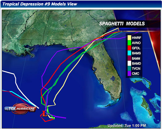
Most models show the system affecting areas of Florida towards the end of the week.
Still to Watch:
99L is projected to make a turn to the Northwest later today and then turn Northeast tomorrow. It is projected to increase in intensity slightly over the next couple of days. Winds remain at to 35 mph and are projected to continue to increase as convection around the low is forecast to increase as the week goes on. Areas of North Central, Big Bend, and the Panhandle should maintain a watchful eye on the storm as the week progresses.
FMIT Member Preparedness Actions
-
FMIT Ride-Out teams are making plans to identify areas for initial deployment as necessary to assist Member with the response and recovery process. FMIT’s Property Insurance Policy affords many benefits to its members.
-
Members should continue to monitor the storm as well as FMIT Alerts and local/national weather forecasts.
-
Members throughout the western coast of FL should begin preparations for potential landfall later this week, which may include communications with internal emergency response leadership.
